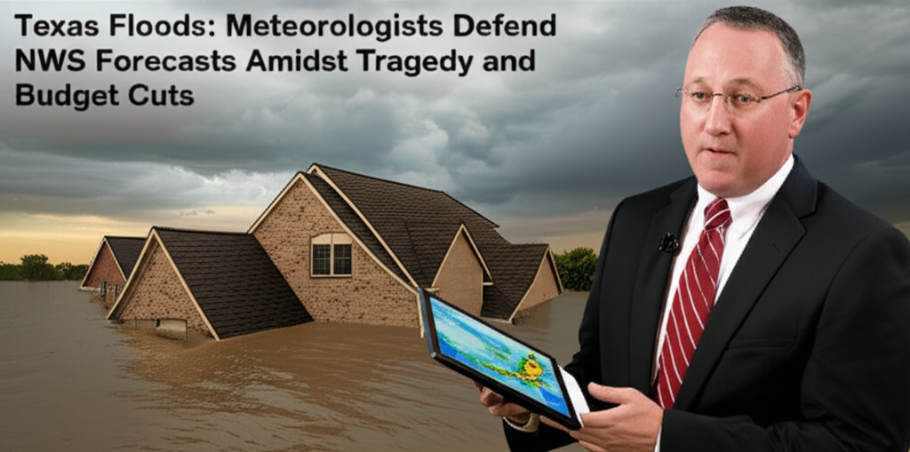
Texas Floods: Meteorologists Defend NWS Forecasts Amidst Tragedy and Budget Cuts
Central Texas recently endured a catastrophic flash flood event over the Fourth of July holiday, resulting in significant loss of life and widespread destruction. At least 27 individuals, including nine children, perished in the sudden inundation. Search and rescue teams worked tirelessly, saving over 850 people from the rapidly rising waters. The disaster left many missing, including a group of young campers from a Christian girls' camp situated along the banks of the Guadalupe River.

In the aftermath, some local and state officials suggested that inadequate forecasts from the National Weather Service (NWS) contributed to the region being caught off guard. This sentiment was echoed and amplified by commentators on social media platforms, who linked the perceived forecasting failure to recent budget cuts imposed on the NWS and its parent organization, the National Oceanic and Atmospheric Administration (NOAA), as part of the Department of Government Efficiency (DOGE) initiative.
However, meteorologists who are deeply familiar with weather forecasting and the NWS's operations offer a different perspective. They contend that the NWS accurately identified and communicated the risk of significant flooding in Texas well in advance of the event. While acknowledging the storm's extreme and unpredictable severity in specific locations, these experts argue that the NWS's forecasts for the week actually underscore the critical importance of maintaining robust funding for the agency, rather than suggesting a failure on its part.
The Genesis of the Storm: A Tropical Connection
The meteorological stage for the heavy rainfall event was set the weekend prior, following the landfall of Tropical Storm Barry in Mexico. Chris Vagasky, an American Meteorological Society-certified digital meteorologist based in Wisconsin, explains the connection: “When you have a tropical system, it’s just pumping moisture northward.” This influx of tropical moisture created an environment ripe for heavy rainfall events across parts of Texas.
Recognizing the potential, the NWS office in San Antonio began issuing predictions early in the week. By Monday, they had already predicted the potential for “downpours” and specifically highlighted the risk of heavy rain during nighttime hours later in the week, a direct result of the atmospheric conditions influenced by the tropical system.
As the week progressed, the forecast became more refined. By Thursday, the NWS San Antonio office had increased their rainfall estimates, forecasting the possibility of up to 7 inches of rain in isolated areas. This level of prediction, several days out, indicated a clear understanding within the NWS of the significant rainfall threat posed by the developing weather pattern.
An Event of Extreme Intensity
While the San Antonio and Hill Country regions of Texas are historically prone to flooding, the storm that struck on Friday morning was exceptionally severe. The Guadalupe River, a key waterway in the affected area, experienced an unprecedented surge, rising more than 20 feet in just a few hours. This rapid and dramatic increase brought the river to its second-highest level ever recorded.
The sheer intensity and localized nature of the rainfall led to statements from local officials expressing surprise. Kerr County judge Rob Kelly told media on Friday morning that the county “didn’t know this flood was coming.” He elaborated on the region's familiarity with flooding, stating, “We have floods all the time… we deal with floods on a regular basis. When it rains, we get water. We had no reason to believe that this was going to be anything like what’s happened here.”
W. Nim Kidd, the Chief of the Texas Division of Emergency Management (TDEM), echoed these sentiments during a press conference with Governor Greg Abbott. Kidd stated that TDEM worked to “refine” NWS forecasts but claimed that “the amount of rain that fell in this specific location was never in any of those forecasts.”
Meteorologists acknowledge the inherent difficulty in predicting the precise location and intensity of rainfall within convective systems like thunderstorms. Chris Vagasky notes that predicting “how much rain is going to fall out of a thunderstorm, that’s the hardest thing that a meteorologist can do.” He explains that numerous unpredictable factors, including an element of chance, influence the exact amount of rainfall in a specific area.
“The signal was out there that this is going to be a heavy, significant rainfall event,” Vagasky clarifies. “But pinpointing exactly where that’s going to fall, you can’t do that.” This distinction between predicting the *potential* for heavy rain over a region and predicting the *exact* spot where extreme, localized downpours will occur is crucial in understanding the challenges of forecasting such events.
Communicating the Risk: Warnings Issued
Despite the difficulty in pinpointing the most extreme impacts, meteorologists assert that the NWS effectively communicated the escalating risk as the event approached. Matt Lanza, another certified digital meteorologist based in Houston, highlights that 8 inches of rainfall in Texas “could be on a day that ends in Y,” emphasizing the region's susceptibility to heavy rain. He points out the challenge of balancing forecasts that often show the potential for extreme amounts of rainfall with the need to adequately prepare the public for rare but severe storms.
“It’s so hard to warn on this—to get public officials who don’t know meteorology and aren’t looking at this every day to understand just how quickly this stuff can change,” Lanza says. He stresses a key takeaway for the public in flood-prone Texas: “Really the biggest takeaway is that whenever there’s a risk for heavy rain in Texas, you have to be on guard.”
According to meteorologists, the NWS did precisely what it was supposed to do as updated information became available. By Thursday afternoon, the NWS San Antonio office had issued a flood watch for the area, indicating conditions were favorable for flooding. As the situation intensified overnight, a flash flood warning was put into effect by 1 am Friday, signifying that flash flooding was imminent or occurring. By 4:30 am, the agency had escalated its alert level, issuing a flash flood emergency alert, the highest level of warning for flash floods, used for life-threatening situations.
“The Weather Service was on the ball,” Vagasky states emphatically. “They were getting the message out.”
The Communication Gap: From Warning to Public
While the NWS issued timely warnings, questions have arisen about how effectively these warnings were disseminated to the public by local authorities. As local outlet KXAN first reported, the initial flood warnings posted by safety officials to the public on platforms like Facebook reportedly went out around 5 am, hours after the NWS had issued its flash flood warning and emergency alert.
This suggests a potential delay or breakdown in the communication chain between the federal weather agency and local emergency management and public notification systems. “Clearly there was a breakdown between when the warning was issued and how people got it, and I think that’s really what has to be talked about,” Lanza observes.
The effectiveness of a warning system relies not only on accurate forecasting but also on the timely and clear communication of that forecast and associated risks to the public. Even the most precise warning is ineffective if it does not reach the people who need to take action to protect themselves.
The Shadow of Budget Cuts
The discussion surrounding the Texas floods inevitably intersects with the recent budget cuts impacting NOAA and the NWS under the DOGE initiative. These cuts have drawn significant attention and concern from the scientific community and policymakers alike. The NWS has reportedly lost more than 500 staffers since the beginning of the year. This reduction in personnel has left some NWS offices unstaffed overnight, raising concerns about the agency's capacity to monitor and warn for severe weather around the clock.
Beyond staffing, key programs and even observational tools have been affected. The NWS has cut back on vital data collection efforts, including reducing or eliminating weather balloon launches across the country. These balloon launches provide crucial upper-air data that feeds into weather models, helping forecasters understand atmospheric conditions. There have also been reports of cuts impacting satellite programs, which are essential for tracking storms and gathering data from above.
Meteorologists have repeatedly warned that these cuts will inevitably make predicting extreme weather more challenging, particularly in an era where climate change is expected to supercharge storms and increase the frequency and intensity of heavy rainfall events. Reduced staffing means fewer meteorologists are available to analyze complex data, run models, and issue timely warnings, especially during rapidly evolving situations or overnight hours.
However, both Vagasky and Lanza emphasize that, despite the broader concerns about the cuts' impact on the NWS's overall capacity, the forecasts issued for this specific Texas event were robust and accurate in predicting the *potential* for a major rainfall and flood event.
“I really just want people to understand that the forecast office in San Antonio did a fantastic job,” Vagansky reiterates. “They got the warning out, but this was an extreme event. The rainfall rates over this six-hour period were higher than 1,000-year rainfall rates. That equates to there being less than 0.1 percent of a chance of that happening in any given year.”
An event of this magnitude, a statistical anomaly occurring with such low probability, presents inherent challenges for even the most sophisticated forecasting systems. While models can predict the *ingredients* for heavy rain, pinpointing where a 1-in-1000-year downpour will occur is beyond the current state of the art.
The Value of Data, Even Under Constraint
Even with reduced resources, the data that was available proved invaluable. Weather balloon launches that did occur, including one sent up over Texas on Thursday, provided critical information. This particular launch revealed a saturated atmosphere with slow-moving winds, a signature pattern that gives forecasters a heads-up about the potential for extreme rainfall.
“This data helps,” Lanza confirms. He speculates on the potential consequences if even this limited data were unavailable: “It probably could have been worse, you know? If you don’t have this data, you’re blind.” This highlights the precarious position the NWS is in, relying on increasingly strained resources to provide essential public safety services.
The Texas flood tragedy serves as a stark reminder of the power of nature and the critical role that accurate weather forecasting and effective warning systems play in protecting lives and property. While the NWS appears to have performed its core forecasting duties effectively in this instance, the event also exposes vulnerabilities in the overall disaster preparedness chain, particularly concerning the timely dissemination of warnings to the public at the local level.
Furthermore, the context of the recent budget cuts to NOAA and the NWS cannot be ignored. While meteorologists argue these cuts did not cause the specific forecasting outcome in Texas, they universally agree that reducing the agency's capacity—through staffing cuts, program eliminations, and loss of observational tools—makes the nation more vulnerable to future extreme weather events. As climate change continues to alter weather patterns, the demands on the NWS will only increase. The ability to accurately predict, monitor, and warn for increasingly intense storms requires sustained investment in the scientific infrastructure and human expertise that the NWS provides. The Texas floods, while a testament to the NWS's capability even under pressure, also stand as a cautionary tale about the potential consequences of undermining the very agencies tasked with keeping communities safe from the elements.
The focus moving forward must be twofold: first, to analyze and improve the critical link between federal weather warnings and local public notification systems to ensure that timely information translates into timely action; and second, to recognize that the essential public service provided by the National Weather Service requires consistent and adequate funding to meet the growing challenges posed by a changing climate and increasingly extreme weather.